3D Geopolitical Map Animation or Data Visualization Engine
2026-03-03 to 2027-03-01·Ongoing
What problem was solved
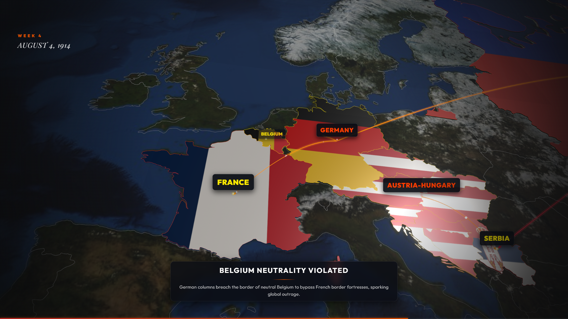
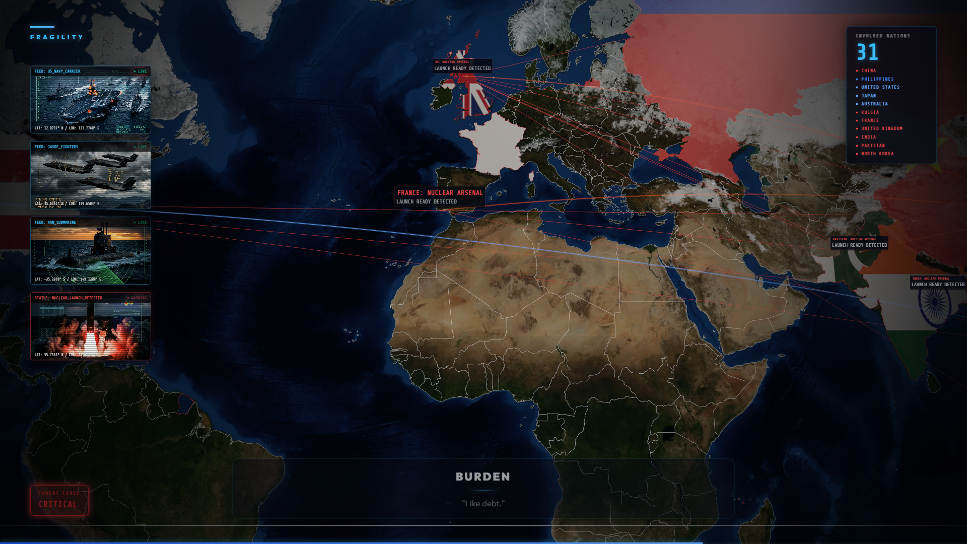
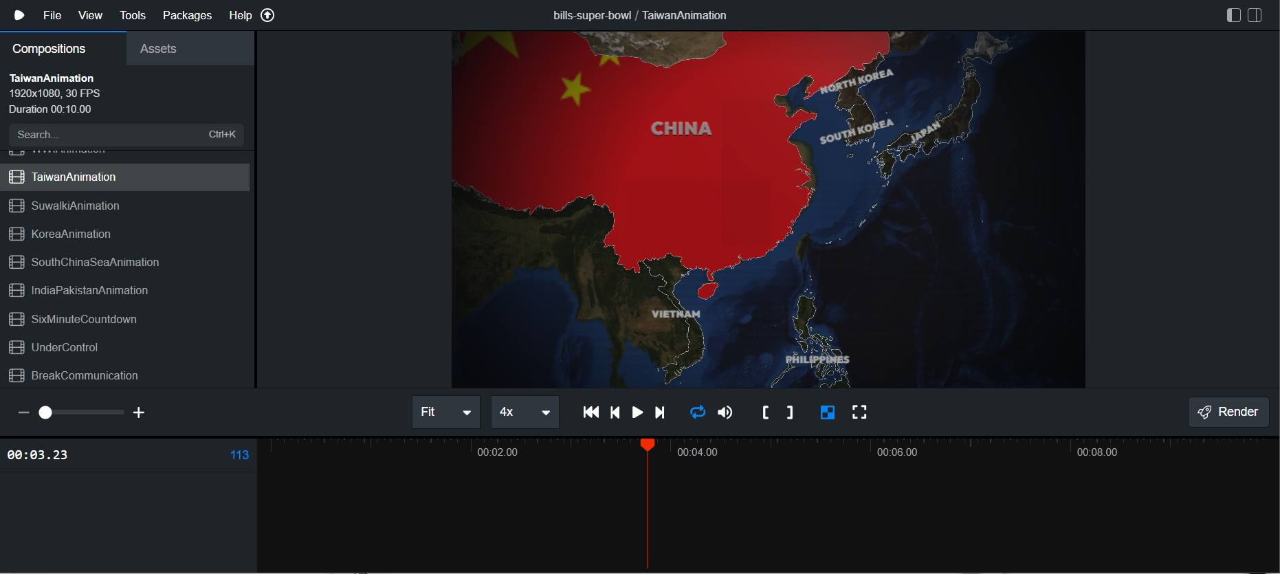
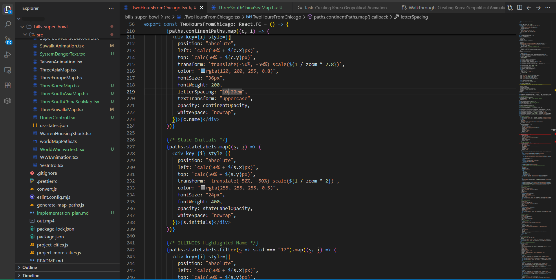
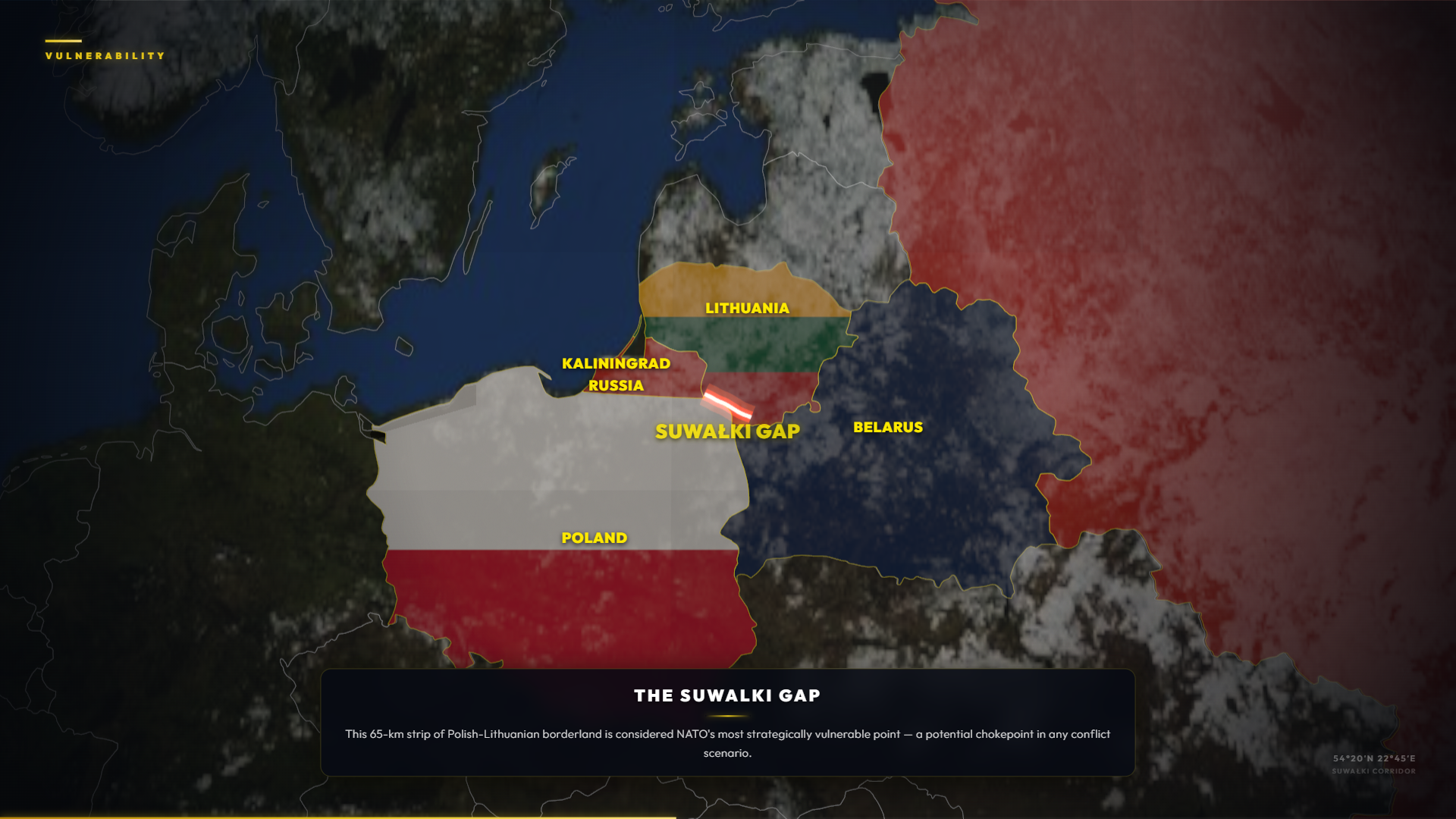
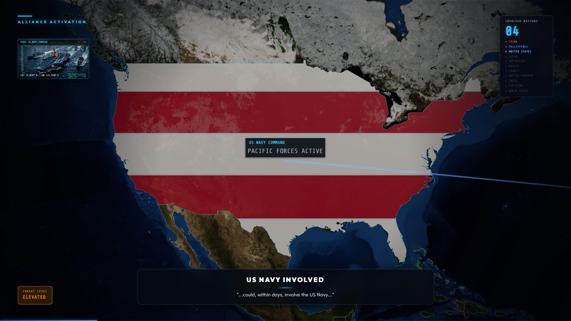
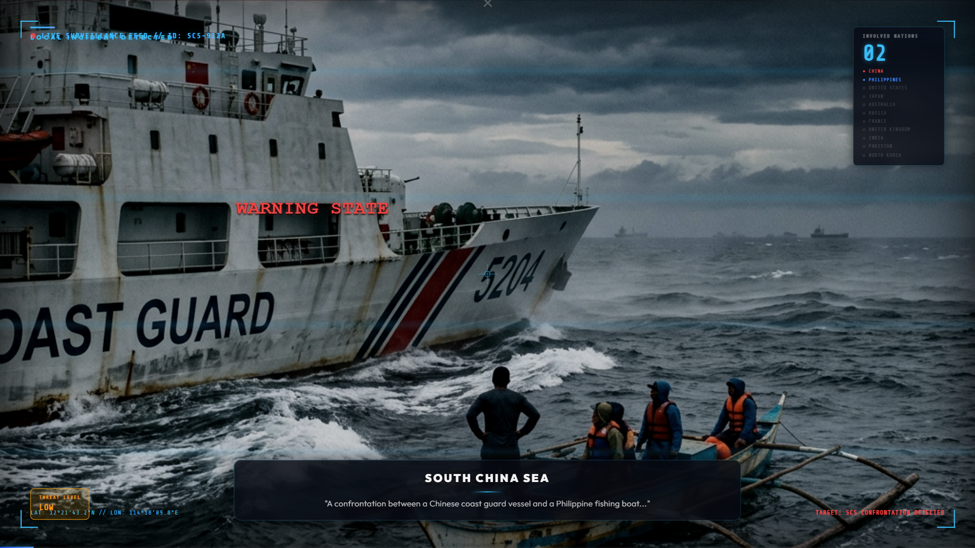
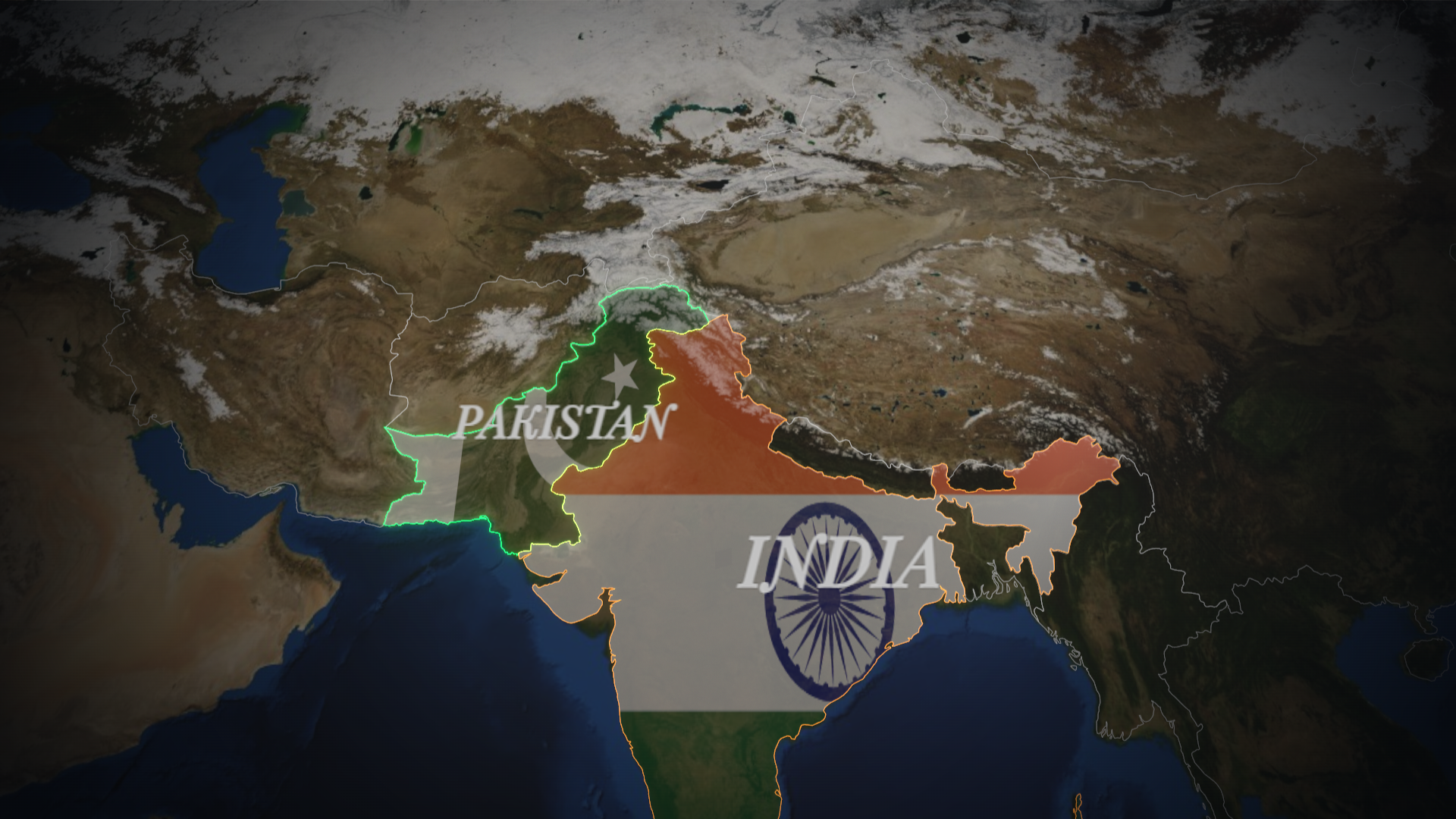
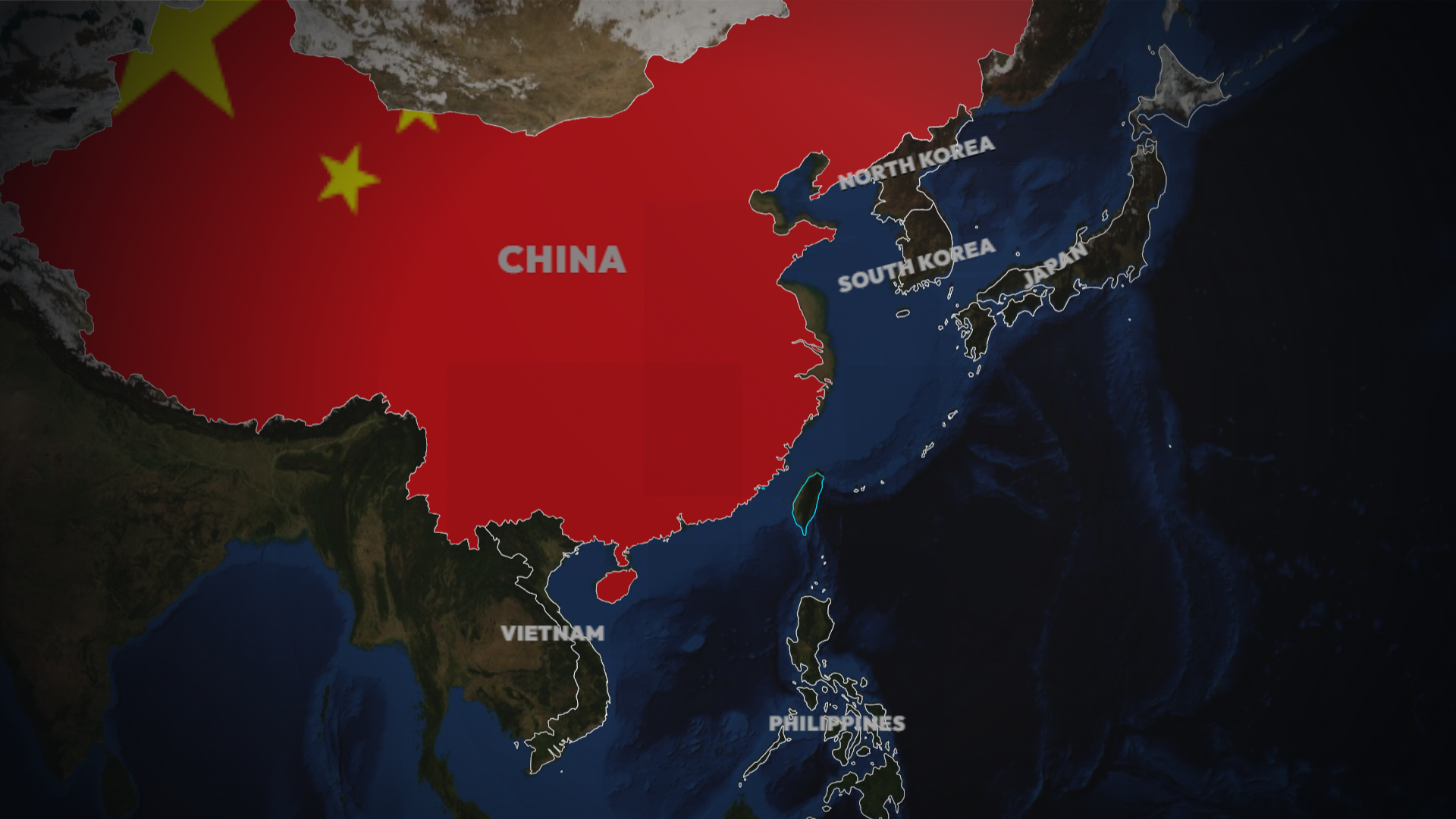
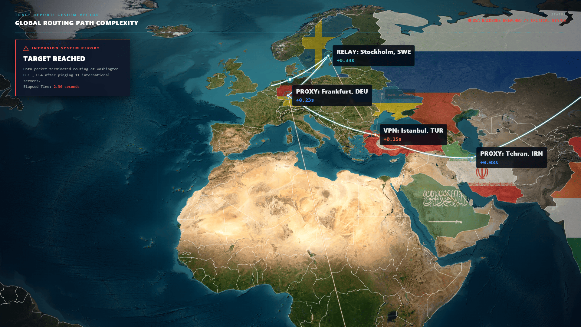
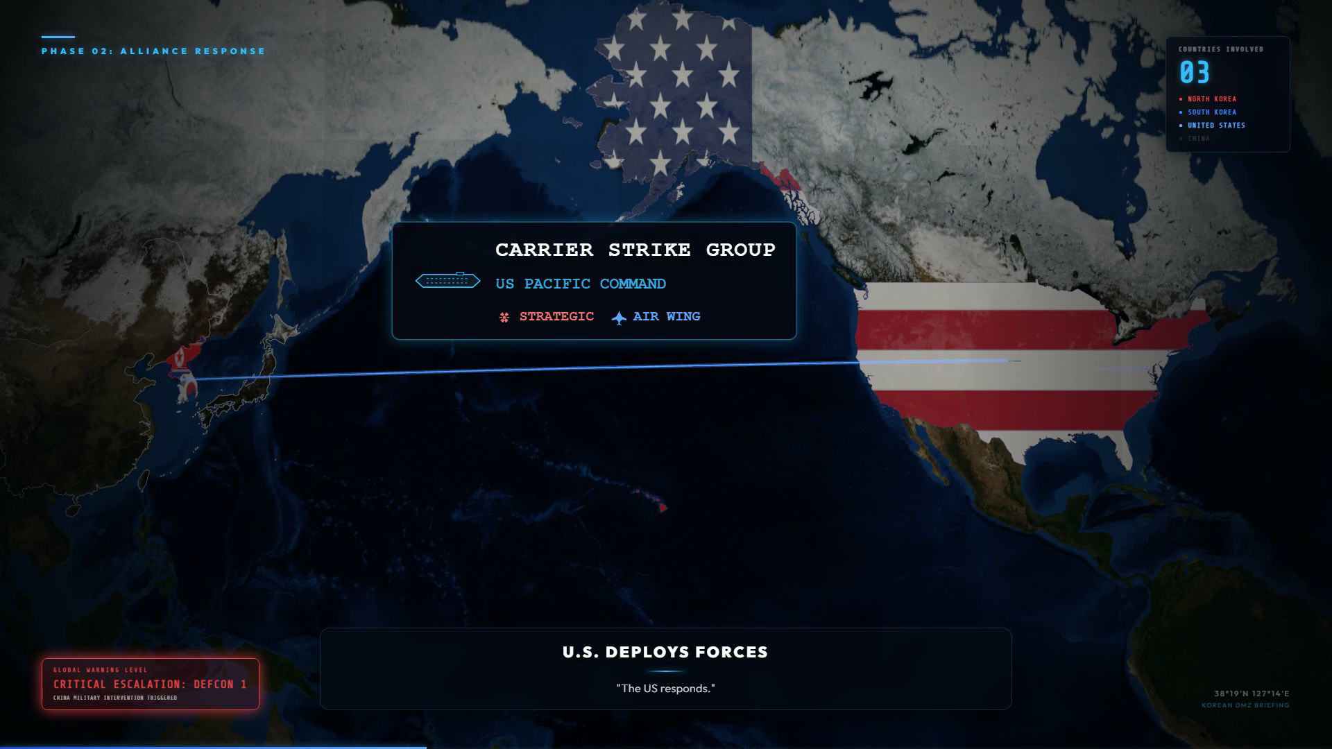
Creating highly detailed, 3D geopolitical animations using standard video editing software is incredibly slow and lacks real geographic accuracy. I solved this by engineering a programmatic map animation engine that layers custom 3D tactical graphics (Three.js) over a mathematically accurate 3D globe (CesiumJS), allowing for the rapid generation of cinema-grade, geographically precise military and geopolitical simulations.
Note: Bridging web-based 3D engines and broadcast animation
Key Features
- Integration with CesiumJS = high-resolution 3D global terrain
- Custom Three.js rendering layer for creating 3D tactical graphics, combat simulations, and alliance lines
- Synchronized dual-camera architecture with the CesiumJS globe
- Dynamic, programmatic camera tracking & zooming across vast geographic distances
- High-visibility = dynamic typography system scaled for cinematic readability and focus
- Programmatic generation and rendering of distinct national borders and geopolitical boundaries
- High-fidelity rendering optimizations designed to leverage high-end hardware for broadcast-grade visual output
Project Outcome
highly scalable rendering engine capable of producing premium, documentary-grade geopolitical animations. By automating the integration of 3D tactical graphics with global terrain data, the system drastically reduced the time required to animate complex map sequences while significantly elevating the overall cinematic production value.
Challenges
main problem is optimizing the rendering pipeline to handle massive amounts of WebGL data specifically rendering high-resolution global terrain alongside custom 3D tactical models.
Project Media


Team members
Technologies Used
Technical Architecture
The core architecture is built upon a synchronized, dual-engine WebGL rendering stack. It utilizes CesiumJS as the foundational layer to render a mathematically accurate, high-resolution 3D globe. Layered directly on top is a custom Three.js environment that handles the rendering of 3D tactical vectors, arrows, and alliance lines. These two distinct WebGL contexts are unified by a highly precise, synchronized virtual camera system. The entire graphical stack is orchestrated within a React component tree and animated programmatically using Remotion, allowing for frame-by-frame control over geographic coordinates, dynamic typography, and camera movements before being compiled into high-fidelity video.
Project Integrity
All source code and architectural documentation for this project are maintained under version control. Technical walkthroughs are available upon formal request.